
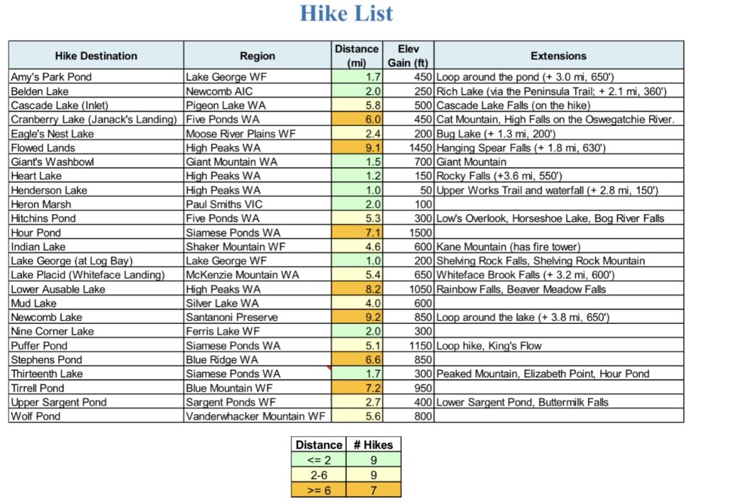
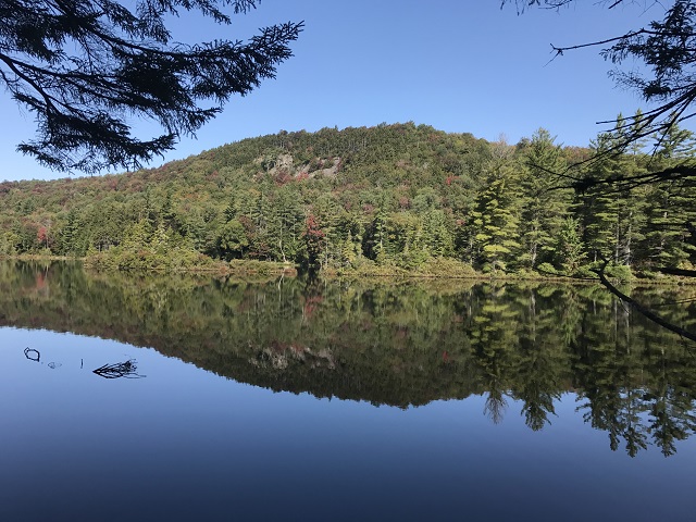
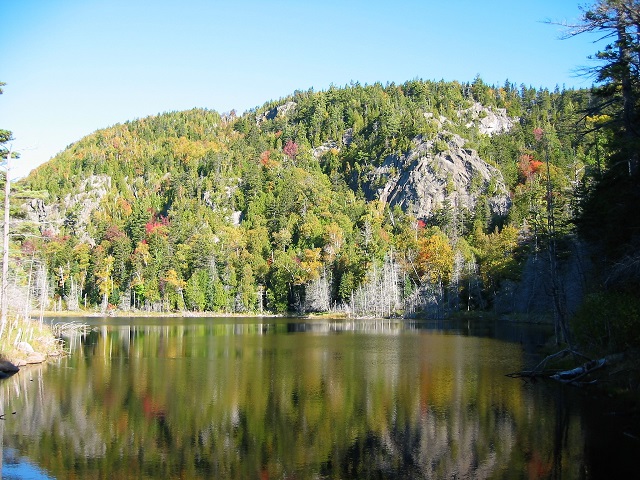
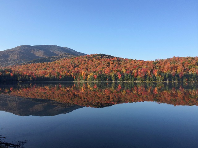
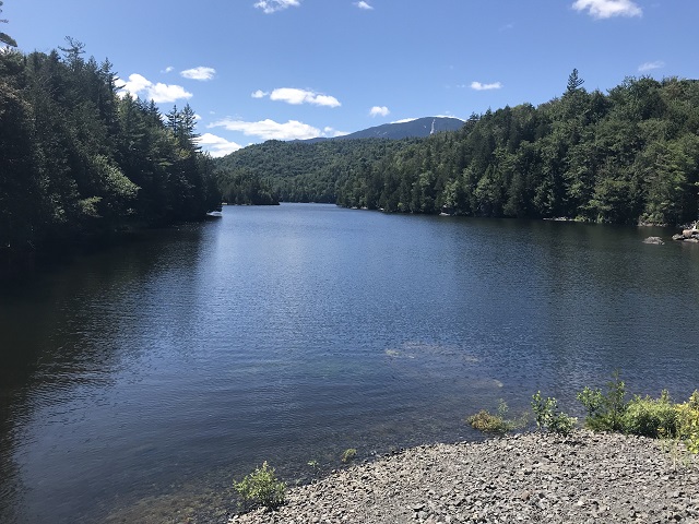
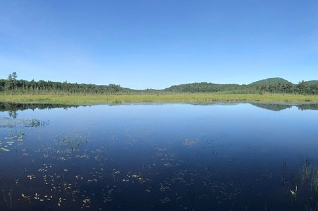
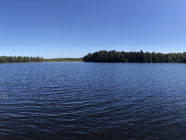
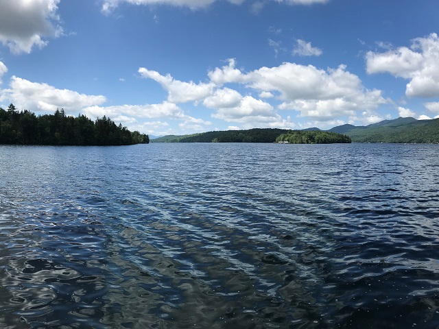
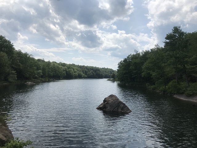
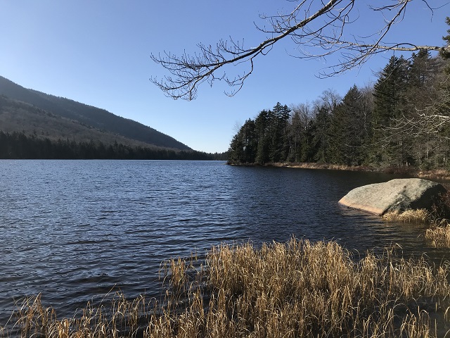
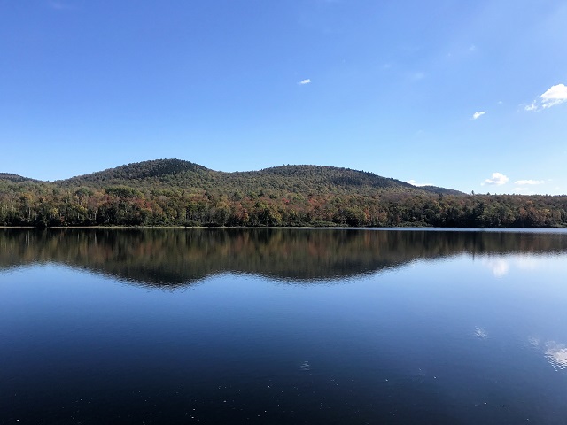
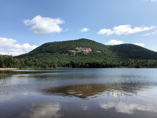
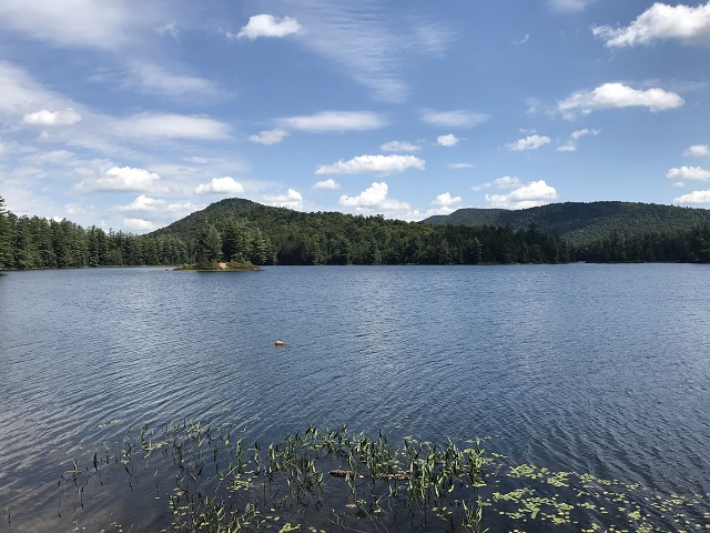
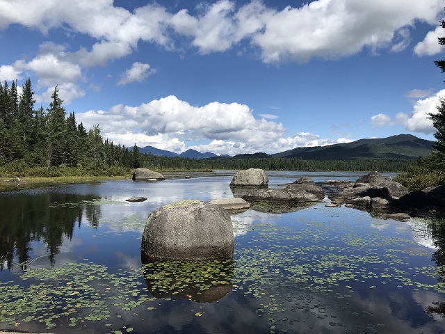
Many Adirondack hiking challenges involve hikes to mountain summits where beautiful lakes and ponds are visible in the distance. This challenge involves hiking along marked trails that lead to a scenic view right at the lakeshore. Each of the 25 hikes on the challenge has a round-trip distance of 1-10 miles.
There are many factors that affect the overall quality and enjoyment of a hike; it’s not just the view at the final destination. A well-defined trailhead reachable via good roads, marked and maintained trails, lack of litter and debris (and, of course, the weather) are but a few that, when coupled with an amazing view, will make you long remember the day. The destinations for this challenge were carefully chosen with these factors in mind.
The hikes are organized into three categories by distance: short (under 2 miles), medium (2-6 miles) and long (6-10 miles). Many of the hikes include “extensions” which are ideas for extending the length of the hike by continuing on to an additional destination or by visiting another nearby hiking trail.
CHALLENGE REQUIREMENTS:
- Visit all 25 lakes and ponds listed below at your leisure and log the date of your hikes using the provided Log Sheet below.
- Hike to an Adirondack lake or pond of your choosing that is not on this list. Hike needs to be between 1-10 miles round trip and within the boundaries of the Adirondack Park. NO PRIVATE PROPERTY hikes allowed-public properties only. Log the lake or pond name, GPS or town location and date of hike in the last line of the Log Sheet.
- Submit the Log Sheet by e-mail to admin@expeditionmidlife.com (you can just e-mail a picture of the completed form to keep things simple).
- Show off your accomplishment by purchasing a patch through the link below.
We LOVE dogs on the trails and will happily bestow an earned patch on them as well! Additional patches may be purchased for $10. Please include your dog’s name with your registration. NOTE: The AMR is a strictly NO DOGS ALLOWED site, therefore Lower Ausable Lake will not be accessible for your dog. We give a pass on this location to any dog hikers so they may still have the patch by doing the rest of the challenge.
While photos are not required for submission, we would love to see your adventures. Email photos to admin@expeditionmidlife.com so we may share on our social media platforms.
Take us along on your journey by tagging us on Instagram and Facebook! @Expedition Midlife #expedition_midlife #expeditionmidlife #patchpursuit #adklakesandponds
*This challenge is subject to change as necessary due to road closures and general ADK restrictions.
DISCLAIMER: Expedition Midlife does not guarantee the accuracy of any trail or parking information, or your health and safety on the trail. Nature is unpredictable, therefore hiking can be an unpredictable venture. Weather conditions elevate the hazards of outdoor recreational activities. We are not liable for any property loss or damage, personal injury, or potential death that may result during your pursuit. Should you choose to accept this challenge, you are agreeing to release challenge creators and Expedition Midlife, both individually and as entities, from any and all liability.
Amy’s Park Pond (easy)
- Hike to a beautiful beaver pond. Follow the Yellow Trail for about 200 yards, then turn right onto the Orange Trail. The pond is reached in about 0.5 mi. At this point, you have the option of returning to your car or continuing along the Orange Trail and then taking the Blue, Red and Yellow Trails for an extended loop hike.
- Lake George Wild Forest
- Google: Amy’s Park, Padanarum Road, Bolton Landing, NY
- Hike Out-and-Back to the Amy’s Park Pond:
Round-trip distance = 1.1 mi
Total elev gain = 200′ - Extended Hike: Loop Hike (via Orange, Blue, Red and Yellow Trails)
Round-trip distance = 4.7 mi
Total elev gain = 1100′ - Trail Info: https://lglc.org/wp-content/uploads/2014/09/2020AmysPark_legal_color.pdf
Belden Lake (easy)
- The well-maintained trails at the Newcomb AIC offer a great way to introduce people to hiking. Park at the Visitor Center. Follow the Blue and Yellow Trails to Belden Lake. When you return to the Visitor Center, you have the option to continue west on the Red and Green Trails to Rich Lake.
- Newcomb AIC (Adirondack Interpretive Center)
- Google: SUNY-ESF Adirondack Interpretive Center
- Hike Out-and-Back to Belden Lake:
Start on the Blue Trail at the Visitor Center
Round-trip distance = 2.0 mi
Total elev gain = 270′ - Extended Hike: Out-and-Back to Rich Lake
Start on the Red Trail at the Visitor Center
Additional Round-trip distance = 2.1 mi
Additional Total elev gain = 360′ - Newcomb AIC website: https://www.esf.edu/aic/
Trail Info: https://www.esf.edu/aic/documents/summermap.pdf
Cascade Lake (moderate)
- Cascade Lake offers a nice loop hike around the lake, with the trail along the north shore coming closer to the lake than the one that runs south of the lake. At the eastern end of the lake is the beautiful Cascade Lake Falls with its nearly 40-foot vertical drop.
- Pigeon Lake Wilderness Area
- Google: Q5J9+H5 Eagle Bay, New York
The parking area is on Big Moose Rd in Webb - Note: The location on Google Maps for the “Cascade Lake Trailhead” (as of Aug 2021) is for an old trailhead.
- Loop Hike Around the Lake to Cascade Lake Falls:
Round-trip distance = 5.9 mi
Total elev gain = 670′ - Trail Info: https://www.cnyhiking.com/CascadeLakeLoop.htm
- For the loop hike, it’s suggested to go out along the south side of the lake and return via the trail on the north side. Note that the trail on the north side of the lake was in better shape when we did the hike, so feel free to take that trail out-and-back to the falls.
Cranberry Lake – Janack’s Landing (hard)
- The Five Ponds Wilderness Area is one of the most remote regions in the Adirondacks. The trail to Janack’s Landing gives one a glimpse of the beauty in this area.
- Note that this hike is best done in the summer or fall following a dry period. The trail from South Shore Road to the turn-off for Janack’s Landing (at 2.9 mi from the parking area) passes through a series of areas with beaver activity and passage can be difficult to impossible after a rainfall or in the spring when the snow is melting.
- Five Ponds Wilderness Area
- Google: 43MM+9W Wanakena, New York
The parking area is on South Shore Rd in Wanakena - Out-and-Back Hike to Janack’s Landing:
Round-trip distance = 6.2 mi
Total elev gain = 450′ - Trail Info: https://www.tupperlake.com/hiking/janacks-landing
Eagle’s Nest Lake (moderate)
- Moose River Plains Wild Forest
- Google: Eighth Lake Campground
- Out-and-Back Hike to Eagle’s Nest Lake:
Round-trip distance = 2.4 mi
Total elev gain = 190′ - Extended Hike: Continue to Bug Lake
Additional Round-trip distance = 1.0 mi
Additional Total elev gain = 150′ - Trail Info: https://www.cnyhiking.com/UncasTrail.htm
- Campground Map showing the start of the trail: https://www.dec.ny.gov/docs/permits_ej_operations_pdf/eighthlake2020.pdf
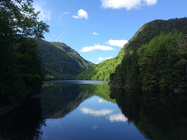
Flowed Lands (hard)
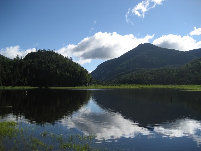
- This magnificent body of water is the result of a dam built on the Calamity Brook to provide cooling water for the blast furnace at the Upper Works. When the winds are calm, the reflection of the towering Mt. Colden in the water provides a very dramatic view.
- High Peaks Wilderness Area
- Google: Upper Works Trailhead
The parking area is on Upper Works Rd in Newcomb - Out-and-Back Hike to the Flowed Lands:
Round-trip distance = 9.0 mi
Total elev gain = 1430′ - Extended Hike: Out-and-Back Hike to Hanging Spear Falls from the Flowed Lands
Additional Round-trip distance = 1.8 mi
Additional Total elev gain = 630′ - Trail Info: https://www.cnyhiking.com/MountMarshall.htm
(refer to the Calamity Brook Trail that leads to the Flowed Lands)
Giant’s Washbowl (easy)
- This beautiful mountain tarn is reached following a stiff climb of 0.7 mi up the Ridge Trail that leads to the summit of Giant Mountain. The climb to the Washbowl is about 20% of the total elevation gain to the summit
- High Peaks Wilderness Area
- Google: 47Q4+9F St Huberts, New York
The parking area is along both sides of NY Rt 73 - Out-and-Back Hike to Giant’s Washbowl:
Round-trip distance = 1.4 mi
Total elev gain = 700′ - Extended Hike: Continue from Giant’s Washbowl to Giant’s Nubble
Additional Round-trip distance = 1.5 mi
Additional Total elev gain = 630′
The hike to the Nubble provides an excellent view of the Washbowl from above. - Trail Info: https://www.cnyhiking.com/GiantMountain.htm
(refer to the parts of the trail that lead to the Washbowl and to the Nubble)
Heart Lake (easy)
- This beautiful little lake is often overlooked by the hundreds of hikers who leave the Adirondack Loj trailhead daily to climb one or more of the high peaks. Hike around the lake, and perhaps go for a swim afterward.
- High Peaks Wilderness Area
- Google: High Peaks Information Center
The parking area is near the end of Adirondack Loj Rd in Lake Placid.
A fee is charged for parking. - Loop Hike Around Heart Lake:
Round-trip distance = 1.2 mi
Total elev gain = 270′ - Extended Hike: Rocky Falls
Additional Round-trip distance = 3.5 mi
Additional Total elev gain = 500′ - Trail Info: https://www.cnyhiking.com/MountJo.htm
(refer to the trails that loop around Heart Lake)
Henderson Lake (easy)
- Henderson Lake is the starting point (cartographically) of the Hudson River. The Hudson flows out of an eastern branch of the lake and begins its 315-mile journey to the Atlantic Ocean.
- High Peaks Wilderness Area
- Google: Upper Works Trailhead
The parking area is on Upper Works Rd in Newcomb - Out-and-Back Hike to Henderson Lake:
Round-trip distance = 1.2 mi
Total elev gain = 50′ - Extended Hike: Upper Works River Trail
Start at the Blast Furnace and follow the new River Trail north toward the Upper Works trailhead.
Additional Round-trip distance = 2.5 mi
Additional Total elev gain = 110′ - Trail Info: https://www.cnyhiking.com/HudsonHeadwaters.htm
Heron Marsh (moderate)
- Heron Marsh has two bridges that provide close-up views of aquatic life in the marsh. In addition to numerous wetland plants, are two beaver lodges, and river otters and muskrats can be seen throughout the year.
- Paul Smith’s College VIC (Visitor Interpretive Center)
- Google: Paul Smith’s College VIC Trailhead & Parking
- Out-and-Back Hike to Heron Marsh:
Round-trip distance = 2.8 mi
Total elev gain = 250′ - Trail Info: http://www.adirondackvic.org/TrailMap.html
Hitchin’s Pond (moderate)
- Hitchin’s Pond is an extremely scenic body of water. The Bog River, with its numerous oxbows, flows out of the pond and empties into Tupper Lake to its east.
- Horseshoe Lake Wild Forest
- Parking Area, Google: 49M3+MH Horseshoe, New York
- Out-and-Back Hike to Hitchin’s Pond:
Round-trip distance = 5.2 mi
Total elev gain = 350′ - Note: Access to Hitchin’s Pond is via a short trail that heads southeast from Low’s Upper Dam (see the map below)
- Extended Hike: Low’s Overlook (in the Five Ponds Wilderness Area)
From the Dam near Hitchin’s Pond:
Additional Round-trip distance = 1.9 mi
Additional Total elev gain = 570′ - Trail Info: https://www.cnyhiking.com/HitchinsPondOverlook.htm
Hour Pond (hard)
- Hour Pond is a very nice day hike, provided it is done at the right time of the year. The trail the turns north from Thirteenth Lake is often overgrown in the summer. Early spring and late fall are the best times to visit this beautiful and remote backcountry pond.
- Siamese Ponds Wilderness Area
- Google: Thirteenth Lake Parking Area
The parking area is at the end of Beach Rd in Johnsburg - Out-and-Back Hike to Hour Pond:
Round-trip distance = 8.0 mi
Total elev gain = 1600′ - Trail Info: https://www.cnyhiking.com/HourPond.htm
- Note that Hour Pond can be reached from other trailheads, including the Old Farm Trailhead and via a trail from Puffer Pond.
Indian Lake (moderate)
- This is a moderate hike along a rugged trail to a scenic backcountry lake.
- Shaker Mountain Wild Forest
- Google: Kane Mountain Fire Tower
The parking area is on Green Lake Rd in Caroga Lake - Out-and-Back Hike to Indian Lake:
Round-trip distance = 4.6 mi
Total elev gain = 600′ - Note: The trailhead for Indian Lake is the same as the one for Kane Mountain.
- Trail Info: https://cnyhiking.com/StewartLake.htm
Lake George at Log Bay (easy)
- This relatively short hike provides an opportunity to see a spectacular waterfall and a beautiful view from the shore of one of the Adirondack’s most popular lakes. Shelving Rock Falls is reached in about 0.4 mi, and Log Bay is about 0.6 mi beyond the falls.
- Lake George Wild Forest
- Google: HC23+QF Bolton, New York
The parking area is along Shelving Rock Rd, just before the Shelving Rock Bridge over the Shelving Rock Brook (see the map below). - Out-and-Back Hike to Lake George from the Parking Area for Shelving Rock Falls:
Round-trip distance = 2.0 mi
Total elev gain = 480′ - Trail Info: https://www.alltrails.com/explore/trail/us/new-york/shelving-rock-mountain-and-shelving-rock-falls-trail?mobileMap=false&ref=sidebar-static-map
Lake Placid at Whiteface Landing (moderate)
- This moderate hike leads to one of the relatively few publicly accessible locations along the shore of Lake Placid.
- McKenzie Mountain Wilderness Area
- Google: Whiteface Mountain via Connery Pond Trailhead
The parking area is on Connery Pond Rd in Lake Placid - Out-and-Back Hike to Lake Placid at Whiteface Landing:
Round-trip distance = 5.4 mi
Total elev gain = 630′ - Trail Info: https://www.alltrails.com/explore/trail/us/new-york/whiteface-mountain-trail-past-lake-placid-and-connery-pond
Lower Ausable Lake (hard)
- Lower Ausable Lake is considered to be one of the most scenic lake in the Adirondack Park. It’s visible from a number of the Adirondack High Peaks, from the end of Lake Road, and from the Scenic Trail that passes along part of its northwest edge on the way to Sawteeth Mountain.
- Adirondack Mountain Reserve (St Huberts), Private Property owned by the Ausable Club that allows hiker access. NO DOGS ALLOWED.
Note: As of May 2021, reservations are required for parking and access to AMR lands (https://www.hikeamr.org/) - Google: St. Huberts Parking Area
The parking area is on Ausable Rd in Keene Valley - Out-and-Back Hike to Lower Ausable Lake via Lake Road:
Round-trip distance = 8.2 mi
Total elev gain = 1030′ - Extended Hike: Out via the East River Trail, back via Lake Road, with a stop at Beaver Meadow Falls
Additional round-trip distance = 0.5 mi
Additional Total elev gain = 280′ - Trail Info: https://www.cnyhiking.com/MountColvin.htm
(refer to Lake Road, the East River Trail, and Beaver Meadow Falls on the map)
Mud Lake (moderate)
- Mud Lake is very scenic and is along a relatively new section of the Northville-Placid Trail.
- Silver Lake Wilderness Area
- Google: 6Q7R+3H Northville, New York
The parking area is on Collins-Gifford Valley Rd in Mayfield - Out-and-Back Hike to Mud Lake:
Round-trip distance = 4.0 mi
Total elev gain = 800′ - Trail Info: https://www.alltrails.com/trail/us/new-york/mud-lake–4
Newcomb Lake (hard)
- The Santanoni Great Camp was built by Robert C. Pruyn, an Albany banker and businessman, as a summer retreat from city life. The main complex and many other buildings on the site have been restored and is now a National Historic Landmark. A good-quality dirt road leads from Rt 28N in Newcomb to the lodge’s site on the shore of Newcomb Lake.
- Camp Santanoni Historic Area
- Google: Santanoni Preserve
The parking area is on Newcomb Lake Rd in Newcomb - Out-and-Back Hike to Newcomb Lake:
Round-trip distance = 10.0 mi
Total elev gain = 500′ - Trail Info: https://www.dec.ny.gov/docs/lands_forests_pdf/mapcampsanta.pdf
Nine Corner Lake (easy)
- While many of the hikes on this challenge lead to remote backcountry destinations where you’ll likely be alone, this lake is just the opposite. It’s a popular swimming spot in the summer, and even on a weekday we had to wait a few minutes to get a parking spot.
- Ferris Lake Wild Forest
- Google: 9 Corner Lake Trailhead
The parking area is on Rt 29A in Caroga - Out-and-Back Hike to Nine Corner Lake:
Round-trip distance = 2.0 mi
Total elev gain = 300′ - Trail Info: https://www.cnyhiking.com/NineCornerLake.htm
Puffer Pond (moderate) UPDATE:OPTIONAL
- Currently, this location is not mandatory due to trailhead closure at the Cabins at Chimney Mountain. Access can be still be gained as an out and back from Thirteenth Lake, but since that would be a 13 mile hike and the limit is 10, we are not including it for the challenge for now. We will update when possible.
- There are multiple routes that can be taken to Puffer Pond, with the two most direct routes listed here. The pond is in a very remote location of the Adirondacks and provides a strong sense of solitude.
- Siamese Ponds Wilderness Area
- Google: Cabins at Chimney Mountain
The parking area is at the end of County Rd 4 (Big Brook Rd) in Indian Lake.
A fee is charged for parking. - Out-and-Back Hike to Puffer Pond (most direct route):
Round-trip distance = 5.0 mi
Total elev gain = 1170′ - Extended Hike: Loop Hike
Start with the most direct route to Puffer Pond, then go west on the Puffer Brook Trail, then north on the Kings Flow East Trail back to the parking area.
Round-trip distance = 7.0 mi
Total elev gain = 1200′ - Trail Info: https://www.cnyhiking.com/PufferPond.htm
Stephen’s Pond (hard)

- This beautiful pond is accessible via a well-maintained section of the Northville-Placid Trail.
- Blue Ridge Wilderness Area
- Google: Northville Lake Placid Trail Head, Blue Mountain
The parking area is on Rt 28 in Blue Mountain Lake - Out-and-Back Hike to Stephen’s Pond:
Round-trip distance = 6.6 mi
Total elev gain = 850′ - Trail Info: https://www.cnyhiking.com/StephensPond.htm
Thirteenth Lake (easy)
- Thirteenth Lake is one of the most popular destinations in the Siamese Ponds Wilderness Area, with opportunities for kayaking, canoeing, camping, fishing and hiking. Note that hike # 12 on this challenge – for Hour Pond – includes this stretch of trail. Therefore, if you decide to hike to Hour Pond from this trailhead, you get credit for both hikes.
- Siamese Ponds Wilderness Area
- Google: Thirteenth Lake Parking Area
The parking area is at the end of Beach Rd in Johnsburg - Out-and-Back Hike Along the Shore of Thirteenth Lake:
Hike out to the junction of the trail to Peaked Mountain
Round-trip distance = 1.9 mi
Total elev gain = 320′ - Extended Hike: Out-and-Back Hike to Peaked Mountain
Additional Round-trip distance = 5.1 mi
Additional Total elev gain = 1540′ - Trail Info: https://www.cnyhiking.com/HourPond.htm
Tirrell Pond (hard)
- The hike to Tirrell Pond begins at the trailhead for the popular hike to Blue Mountain, so even though the parking area has many cars, it’s unlikely that you’ll see many people on the trail to the pond. The pond has a nice sandy beach that’s very conducive to rest and relaxation.
- Blue Mountain Wild Forest
- Google: Blue Mountain Trailhead
The parking area is on NY-28N in Blue Mountain Lake - Out-and-Back Hike Along to Tirrell Pond:
Round-trip distance = 7.0 mi
Total elev gain = 870′ - Trail Info: https://www.cnyhiking.com/TirrellPond.htm
Upper Sargent Pond (moderate)
- Part of a pair of ponds (Upper and Lower Sargent Ponds), this pond offers a very scenic view and is a prime location for fishing.
- Sargent Ponds Wild Forest
- Google: VFM3+24 Indian Lake, New York
The parking area is on Rt 3 (North Point Rd) in Indian Lake - Out-and-Back Hike to Upper Sargent Pond:
Round-trip distance = 3.0 mi
Total elev gain = 390′ - Extended Hike: Out-and-Back Hike to Lower Sargent Pond
For Trailhead, Google: VCMF+C4 Indian Lake, New York
Parking Area is about 1.6 mi farther west of the PA for Upper Sargent Pond and is also on Rt 3 (North Point Rd).
Additional Round-trip distance = 4.8 mi
Additional Total elev gain = 500′ - Trail Info: https://www.cnyhiking.com/SargentPonds.htm
Wolf Pond (moderate)
- Wolf Pond provides one of the most scenic views of the High Peaks, including the highest one, Mt. Marcy. The trail was built in 2018 and is in pristine condition.
- Vanderwhacker Mountain Wild Forest
- Google: W2VW+99 Boreas River, New York
The parking area is on Blue Ridge Rd in Minerva - Out-and-Back Hike Along to Wolf Pond:
Round-trip distance = 5.6 mi
Total elev gain = 800′ - Trail Info: https://www.cnyhiking.com/WolfPond.htm